Gear companies test in Utah because the conditions that break products sit within a day's drive of one another, and most of the ground in between is public. The state's official record high and record low are more than 186 degrees apart, and the federal government owns 64.4 percent of the land. The advantage is the geography. The permit rules are federal, and in a few canyons the local ones are stricter.
Quick answers
Why do companies test products in Utah?
The state runs from 2,178 feet to 13,528 feet, and its official temperature records span 117 degrees to 69.3 below zero. The federal government owns 64.4 percent of the land.
Can you test a car at the Bonneville Salt Flats?
Yes, with a special recreation or film permit from the BLM's Salt Lake field office. The flats close to motor vehicles in spring, when the salt is wet.
How much of Utah is public land?
The federal government owns 64.4 percent of it. The BLM alone manages nearly 22.8 million acres, about 42 percent of the state.
Do you need a permit to photograph gear on BLM land in Utah?
Not for a crew of five or fewer that meets the EXPLORE Act's conditions. Larger shoots need a permit, which the BLM says typically takes at least 30 to 60 days.
How much does Utah's elevation and weather vary
Utah's highest point is Kings Peak in the Uinta Mountains, at 13,528 feet, according to the Utah Geological Survey. Its lowest is Beaver Dam Wash on the Arizona line, which a survey geologist put at 2,178 feet. That leaves 11,350 feet of altitude to test a stove or a pair of lungs against without crossing a state line.
The heat record belongs to St. George, which hit 117 degrees on July 5, 1985, and again on July 10, 2021. Before a NOAA committee accepted the 2021 reading, it threw out a 120 from a weather station on a school district roof. Ski Utah4 puts Brian Head, the resort with the highest base area in the state, 84 miles from St. George, about an hour and a half.
The cold record is stranger. On February 1, 1985, a limestone sinkhole called Peter Sinks, 20 miles northeast of Logan, fell to 69.3 below zero. The Utah Climate Center at Utah State University says that is the second-coldest reading on record in the lower 48. The sink sits at 8,164 feet with no valley outlet, so on calm, clear nights the cold air slides in and stays.
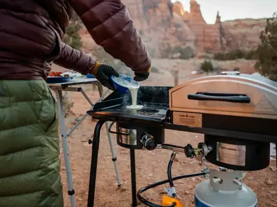
Peter Sinks is in the Bear River Mountains. Camp Chef, founded in Logan in 1990, once described its home on its About page as Cache Valley, "surrounded by the beautiful Bear River Mountain Range, a perfect site for product testing." Perfect covers a lot of ground there.
Which gear brands test in Utah
Several companies in this directory say so on their own sites. Klymit, the sleeping pad company in Kaysville, says its team "designs and tests all of our gear in the illustrious deserts and mountains of Utah." Blue Ice, a French mountaineering brand, keeps offices under Mont Blanc and in Salt Lake City near the Wasatch, and says, "Our backyard is where we field test our products."
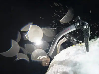
Black Diamond wrote it into its company history. The page says Salt Lake City became a proving ground, with employees designing products "that they could then test in the Wasatch mountains flanking the offices of BD."
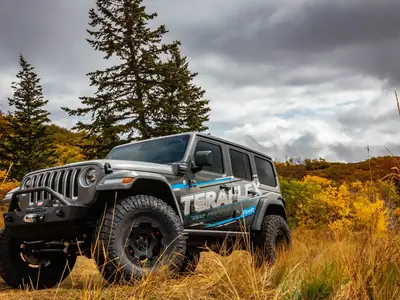
TeraFlex, now run from West Jordan, built a suspension kit in 1996 for the first TJ Wrangler it could get its hands on. "We made it work the way we thought it should in Moab and on the highway," the company said on its blog in 2015.
Not every Utah company did its first test at home. Goal Zero, headquartered in Bluffdale, says its first solar power pack was tested in the Democratic Republic of the Congo in 2008, a year before the company launched as a business.
Can you test at the Bonneville Salt Flats
Yes, with a permit. The federal government once set land aside for exactly that. In 1952 Public Land Order 852 reserved 8,927 acres of the salt flats, including the old circular track, "for administration as an automobile racing and testing ground," according to a 2002 paper by the manager of the BLM's Salt Lake field office. The withdrawal expired in 1982. The same paper lists automobile testing among the compatible scientific uses for the area, and it names Nissan and Daimler/Chrysler among the carmakers that shot commercials there.
The BLM now says anyone using the flats for land speed racing, photography, videography or scientific research needs a special recreation or film permit from that office. The racing goes back to 1914, when a Blitzen Benz ran 141.73 mph for an unofficial record. The BLM's 2026 calendar gave the Southern California Timing Association's event July 27 to August 8. Every new driver sits through Rookie Orientation before touching a course.
Manufacturers come for the record books. On August 23, 2006, the British machinery maker JCB averaged 350.092 mph in its DieselMax streamliner, a world speed record for diesel-powered vehicles, powered by two of its own 444 diesel engines built in Derby. Farmers Weekly reported that a JCB Fastrac tractor pushed the car to 40 mph to start its run. Ten years later, a member of the record team said they were still world champions.
The salt does not always cooperate. The BLM closes it to motor vehicles in spring, when the surface is moist or under water. Speed Week was canceled in 2014 after a monsoon storm left standing water, and again in 2015. "The main international racetrack used to be 13 miles in length. Now we can't even find 7 miles," Stuart Gosswein of Save the Salt said that year. In 2022 rain flooded the courses on the opening weekend, and the SCTA posted that "Speedweek 2022 is officially cancelled."
How much of Utah is public land
The federal government owns 64.4 percent of Utah, second only to Nevada, according to a 2025 report from the Kem C. Gardner Policy Institute. Just over a fifth, 21.1 percent, is private. The Bureau of Land Management alone manages nearly 22.8 million acres, about 42 percent of the state, and more of our sourced numbers are on the Utah facts page.
What that means for access depends on what you are doing. At the salt flats, the BLM's 2002 paper said no fees were charged for casual, noncommercial use such as sightseeing. The BLM says a Special Recreation Permit may be required for organized events and competitive uses. It tells applicants not to advertise, collect fees or begin operations until they have written authorization. Whether a particular product test needs one is a question for the local field office.
The places in Utah with "proving ground" in the name belong to the military. Dugway Proving Ground and the Utah Test and Training Range are two of the three military sites that, by the Gardner Institute's count, put 33.8 percent of Tooele County under the Department of Defense.
Do you need a permit to film or test gear on Utah public land
For small shoots, less often than before 2025. The EXPLORE Act, which became law in January 2025, bars agencies including the BLM and the Forest Service from requiring a permit or a fee for filming and still photography by five or fewer people, as long as the crew uses handheld equipment and stays where the public is allowed, among other conditions. Crews of six to eight get a no-fee authorization instead, according to the Congressional Research Service. The Forest Service's rule putting that into its regulations took effect March 19, 2026.
Bigger productions still apply. The BLM says a film permit typically takes at least 30 to 60 days and requires a certificate of insurance naming the agency. Its salt flats page still lists photography and videography among the uses that need a permit, so call the Salt Lake field office before you unload the tripod. None of this is a Utah exemption, either. The law covers federal land in every state.
Some local rules are tighter than anything federal. Dogs are prohibited in the protected watershed areas of four canyons above Salt Lake City, which are City Creek, Parleys, Big Cottonwood and Little Cottonwood, because Salt Lake City Public Utilities says the snow and rain there supply about 60 percent of the drinking water. In City Creek that means above the water treatment plant, about three miles up. A violation is a Class B misdemeanor. So a company testing a dog harness can't bring the dog up Little Cottonwood. Mill Creek Canyon, on the utility's list of places to take a dog, lets dogs off leash on its trails on odd-numbered days and requires leashes on even-numbered days. Book the harness test accordingly.
Brands in this answer